Day 3
Ouray KOA Ouray, Colorado
We started the day by taking care of some business. Of course, we packed a picnic and then headed out. We started on route 550. This is a narrow road with steep drop-offs and no guardrails. We wanted to see if we might be able to drive here with the RV later this week. We want to go to the town of Durango and 550 is the road to take. Tractor trailers use this road and we think that when the time comes, we can too!


We took the road to Ophir Pass.


At the highest elevation, we were at 11,789 feet. This mountaintop was above the tree line and it was a very ragged and an inhospitable environment.


As we mounted the pass, there was a tremendous view on the other side. The steep way down the mountain was a rocky shelf only wide enough for one vehicle at a time. We waited at the top as a line of Jeeps and motorcycles made their way up.


We made our way into the tiny town of Ophir.


There is a lot of recent avalanche damage high on all of the mountains. Last year, this area had a higher than usual amount of snow.

We drove to the town of Telluride. This is an upscale ski resort town.

We found the Telluride Town Park for our lunchtime picnic.

Magpie.

Today was not a day to see the town…we were on our way to the next mountain trail, Imogene Pass.


The guidebook we are using rates this as a difficult trail. It also states that the “views are reserved for the adventurous few.” It is the second highest pass in Colorado…and one of the “most thrilling!” This is not a trail to be taken lightly. We had to use extreme care with vehicles approaching from the other direction.


As we climbed the mountain, we could see the zigzag trail that is the Black Bear Pass.

We left Telluride and the ski trails far below.


The aspen trees are just starting to turn golden at the higher altitudes. We could see falling leaves glinting in the sunlight as they floated from the trees.

The Tomboy Mining town has been long abandoned. The are shacks, sheds, shafts, equipment, tailings, twisted metal, and timber all left behind.


Loveliness…


As we travel these trails, if we see someone stopped, we stop to check on them…it’s what you do out here…you pull over and ask if help is needed.
Today, there was a guy on a motorcycle that had wiped out on the incline to Ophir’s Pass. He and his partner were debating whether they should move forward or retreat. Another man on a motorcycle became short of breath and lightheaded near the top of Imogene Pass. His friend was walking him back down the trail. It’s important to have the right machine to ride here. We saw a man driving a Land Cruiser. As he went down a difficult and steep set of rocks, we heard the grating sound of metal scraping rock…not so good. With our short wheel base and larger and lifted tires, we were slowly and safely making our way! Tim carefully navigated the boulders strewn in our path…quite like picking his way through a minefield. The book calls it driver’s choice…the driver has to choose between the better of two evils.
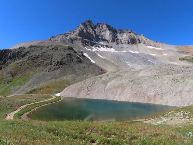
Imogene Pass 13,114 feet…as high as we have been…unbelievable…so pretty!


Check out this snowbank!


The way down.


Yes this is the road!!!

We also met a hiker/runner. He was running to Ouray from Telluride…he was amazing!!! He actually beat us down the mountain…we had to go so slowly. When we passed him close to Ouray…5 or 6 miles later, Tim stopped and told him he was a “badass man!” The runner thanked him and just kept on running!

Imogene Pass was a very beautiful and dramatic ride. We are happy to be among the “adventurous few!”


